About SAnD
Executive Summary
Mission
The mission of the Sedimentary Analogs Database and Research Consortium (SAnD) is to provide our industry members a source for rigorously collected, carefully analyzed, and systematically organized data on clastic reservoir architecture and depositional system morphology, as well as for regional context studies, modeling methodologies, and data-collection techniques and tools so members can assess their own data.
Goals
- To provide quality research observations, data and products that are timely, pertinent and easily incorporated into our sponsors’ business
- To develop predictive models of clastic systems architecture, development, and response to change
- To educate students and advance scientific understanding of the evolutionary process of continental margins around the world
Approach
The project team utilizes both small (hundreds of sq km) and large (thousands of sq km) 3D data sets to allow harvesting of clastic architectural data on various elements of the depositional systems. Seismic architecture is investigated using techniques that employ conventional seismic sequence framework development, quantitative seismic geomorphologic analysis, various attribute extractions, export and harvesting of morphologic information in ArcGIS and ErMapper, and import of these data into various programs for statistical analyses of temporal and spatial distribution and relationships.
The team also works with a significant legacy archive of outcrop data provided from decades of clastic systems research at the Bureau, as well as with data from current outcrop studies. These outcrop results consist of thousands of detailed facies, lithology, and shale architecture measurements, integrated with over 100 kilometers of detailed architectural drawings from photopanoramic images. Datasets include significant subsurface logs integrated with outcrop data, as well as porosity, permeability, and velocity measurements. These data are being harvested for the morphologic information that they document. Both the seismic-derived and outcrop-derived data form the basis for probabilistic models of reservoir occurrence, character, and evolution. Results are conveyed to members as statistical as data sets, modeling studies using both Schlumberger’s Petrel and Landmark’s DecisionSpace software, and are combined with results from published works and previous studies to form a larger searchable Sedimentary Analogs Database (SAND).
Current Study Areas
Seismic data is our currency. We pride ourselves in the breadth of our research both geographically and in the geomorphologic settings that we investigate. These data provide a three-dimensional view of systems that simply can not be viewed in even outcrop. Seismic studies are complimented with outcrop studies in similar depositional systems to form observations at a variety of scales.
Studies currently underway include:
- 3D modeling approaches in complex tidally influenced shorelines (modeling, outcrop and subsurface)
- 3D modeling in shelf deltaic deposits of the Pennsylvania (Petrel, ArcGIS, Lidar) Influence of Submarine Topography in deposition of deep water facies (numerical modeling and seismic-log-core studies) 3D modeling in shelf deltaic deposits of the Pennsylvania (Petrel, ArcGIS, Lidar) Influence of Submarine Topography in deposition of deep water facies (numerical modeling and seismic-log-core studies)
- 3D modeling of complex shoreline deposits (various localities)
- Sand distribution across wave and storm influenced shelves (seismic and logs)
- Reservoir distribution in the El Vado, Tocito and Gallup shelf systems of the San Juan Basin, New Mexico
- Application of hyper spectral analysis to distribution of clays and clay types in high net:gross fans, mass failures, etc. (New Zealand, Borneo, Arkansas)
- Mass Transport Deposits – rheology and morphology, nature of clay deformation and implications for sealing capacity (outcrop, laboratory analysis, subsurface seismic, log and core data; New Zealand, Borneo, Arkansas).
- Active versus passive margin fan development; architecture, facies distributions, etc. (outcrop and subsurface studies; Arkansas)
- Rift basin accommodation formation and fill; Australian northwest shelf, Albuquerque Basin, New Mexico
- Seismic geomorphology of axial versus transverse fluvial systems in rift settings (northwest shelf of Australia)
Some areas currently under study:
- Gulf of Mexico, U.S.A. (deep and ultradeep, shallow shelf, onshore)
- Utah Book Cliffs Sego Sandstone
- New Mexico San Juan Basin Tocito Sandstone and El Vado Sandstone
- North Slope Alaska Prince Creek and Schrader Bluff Formations
- Canada McMurray Formation
- New Zealand Taranaki Basin
- Trinidad Eastern and Northern Offshore Marine Areas
- North Sea Heidrun Field
- Morocco Eastern Offshore
Challenge(s)
Clastic systems are highly complex and deterministic description is often highly uncertain. Probabilistic approaches require dense databases, but those data must be quality controlled and rigorously collected to ensure quality. The SAnD consortium is providing those data bases as well as cutting edge research to support understanding of these systems and the context within which such data is collected.
As companies grow, so do the challenges of disseminating information throughout the organizations. Companies rely more and more on electronic dissemination of corporate knowledge. The SAnD consortium is providing digital products that are user friendly, not space intensive, interactive and informative for all levels of geoscience experience.
Reservoir bodies are three-dimensional. Complexities involved in finding and producing both deep and shallow marine, and fluvial deltaic reservoir systems are four dimensional, involving temporal variability as well as spatial variability. For this reason, geoscientists must turn to multi-dimensional data sets to provide insight into these systems. 3D seismic provides the spatial and temporal perspective, but outcrop and core analysis of such deposits strengthen the details needed that can escape us a the seismic scale. The SAnD consortium is heavily focused on providing answers using 3D seismic data, ground truthed with sediment data and outcrop understanding.
Staff
- Lesli J. Wood, Professor and PI; Seismic geomorphology, subsurface and outcrop studies
- Darrin Burton, Affiliated Faculty; outcrop and subsurface to modeling research
- Mary Carr, Research Administrator; outcrop and subsurface studies, modeling approaches
- Andi Niess, Webmaster
Terms
- Research calendar each year begins January 1 and runs through December 31.
- One to two annual meetings held worldwide
- Access to research group’s website is limited to membership years; however annual folders of material remain available for years of membership
- Annual 2 day visit to member offices to work with geoscientist, teach, etc.
- A standard letter of agreement
- $45,000 per company per year
Research Methodology
Areas of Focus
Seismic Analysis
The project team acquires both small (hundreds of sq km) and large (thousands of sq km) 3-D seismic data sets to allow harvesting of morphometric data on various elements of the depositional systems. The seismic is investigated using techniques that employ conventional seismic sequence framework development, quantitative seismic geomorphologic analysis, various attribute extractions, export and harvesting of morphologic information in ArcGIS and ErMapper, and export of these data into various programs for statistical analyses of temporal and spatial distribution and relationships.
Quantitative Seismic Geomorphology
Quantitative seismic geomorphology (QSG) is a new direction in the application of seismic geomorphology that will create a step change in our knowledge and characterization of older clastic environments. QSG is a technique that uses 3-D seismic data integrated with core and logs to investigate the nature and architecture of reservoirs through quantitative data collection of the system’s morphometrics through analyses of spatial and temporal variability of reservoirs. Techniques integrate seismic investigation, visualization, GIS and ERMapper tools and statistical analysis.
Data Mining of Modern and Ancient Systems
The QCL team also works closely with the LASR research group to mine the significant historical archive of outcrop data provided from previous clastic systems research at the Bureau. These outcrop results, collected mostly on shallow marine and fluvial systems of the U.S. Western Cretaceous outcrops, consist of thousands of detailed facies and lithology measurements, integrated with over 100 kilometers of detailed architectural drawings from photopanoramic images. Datasets include significant subsurface logs integrated with outcrop data, as well as facies porosity, permeability and velocity measurements. These data are being harvested for the morphologic information that they document.
Technology Transfer
Both the seismic-derived and outcrop-derived data form the basis for probabilistic models of reservoir occurrence, character and evolution. 3-D Visualizations of these research results are conveyed to members as are statistical data sets, vrml-based training modules and are combined with results from published works and previous studies to form a larger HTML-based Sedimentary Analogs Database (SAND).
SAND MENU
Research Staff
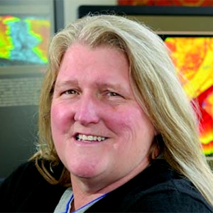
Lesli Wood
Weimer Distinguished Chair and SAnD Principal Investigator
303-273-3901
lwood@mines.edu

Lorena Moscardelli
Research Fellow
512-471-1534
lorena.moscardelli@gmail.com

Darrin Burton
Research Fellow
Currently employed with Anadarko in Denver, Colo.
darrinburton@hotmail.com
Collaborating Researchers

Paul Mann
University of Houston, Earth and Atmospheric Sciences, Professor of Geology, Tectonics and Petroleum Geology
713-893-1731
pmann@uh.edu

David Mohrig
University of Texas, Jackson School of Geosciences, Professor, Department of Geosciences
512-471-2282
mohrig@jsg.utexas.edu
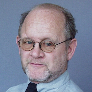
Ronald Steel
University of Texas, Jackson School of Geosciences, Davis Centennial Chair and Professor
512-471-5172
rsteel@jsg.utexas.edu

Rob Gawthorpe
Professor of Petroleum Geology, University of Bergen, Norway
rob.gawthorpe@geo.uib.no

Zane R. Jobe
Research Associate Professor, Colorado School of Mines
Director, Chevron Center of Research Excellence
zanejobe@mines.edu
Graduate Student Researchers
Doctoral Candidates
Hirofumi Kobayashi
Current research: Deepwater fold and thrust belts: structure and sediment interactions. Numerical modeling gravity flows in complex fold and thrust belt settings. Development of an atlas of deepwater fold and thrust belts that documents nature of these complex settings around the world and throughout the geologic record.
Morphological and geological characterization of mass-transport deposits and seal integrity issues in deepwater fold and thrust belt, offshore Malaysia
Pengfei Hou
Stratigraphic architecture and depositional environments of a mud-rich, fine-grained early foreland basin source-to-sink system – Pennsylvanian Atoka Formation in Arkansas and Oklahoma. He will also investigate the differences and similarities of the Atoka Formation and the older Jackfork Group in lithologic facies, stratigraphic architecture, ichnology, and paleogeography etc. His work will have important implications for understanding the stratigraphic evolution of the Arkoma Basin and the Ouachita Fold and Thrust Belt.</p><p><a href=;” />
Confined to unconfined deepwater fan archiectures: a case study in the Pennsylvanian Jackfork Sandstone and Atoka Formation of the Ouachita to Arkoma Basin transition
Leiaka Welcome
Current research: Comparison of the stratigraphy, sedimentology and seismic geomorphology of marine versus non-marine rift basins. Encompasses work in the Albuquerque Rift (continental rift) as well as rift basins of the north west shelf of Australia (marine rifts) and possibly the U.A. east coast Atlantic rifts.
Non-marine-Attached Rift Basins: a stratigraphic and sedimentologic study of the Rio Grande Rift Systems, continental U.S.
Sebastian Cardona
Current research: Investigating the sealing properties of mass transport deposits in deep water settings. In order to do this, he is integrating different data sets and methodologies such as seismic, well log, outcrops and microscopic data. His current study areas are located in offshore Eastern Gulf of Mexico and the deep water outcrops of the Taranaki Basin, New Zealand.
Predicting the Seal Quality in Mass-Transport Deposits: New Zealand Outcrops and Microscopy Studies
Hang Deng
Current research: The influence of topography on gravity-flow-driven processes and the resultant deposits. Numerical modeling of gravity flow processes over a variety of topographies that range from in-canyon, slope, mass transport surfaces, slope to basin-floor transitions. Will utilize highly detailed three dimensionally derived surfaces, as well as designed topographies.
The Influence of Topography on Subaqueous Sediment Gravity Flows and the Resultant Deposits: Examples from Deep-water Systems in Offshore Morocco and Offshore Trinidad
Master's Candidates
Stephen Schwarz
Current research: Study involves modern systems morphometric analysis of drainages in rifts of the East Africa, and use of observations to interpret nature of rift channels in offshore Northwest Australia’s Dampier Sub-basin rifts using seismic geomorphic analysis of 3D seismic, and core and log channel thicknesses for calculating flow parameters, drainage sizes and drainage basin extents.
Drainage Systems in Rift Basins: Implications for Reservoir Quality
Andrew Reisdorf
Current research: Study focuses on creating a detailed 3D reservoir model of the deltaic Pennsylvanian Atoka Formation. Deltaic deposits produce billions of barrels of hydrocarbon worldwide. However, complexities and variations in deltaic geobody geometry, sediment volume, and internal architecture often result in a large amount of unproduced resource. This model will illustrate fluid flow connectivity of a compositional and geometrically complex reservoir, detailing the importance of shale continuity and distribution in baffling and blocking flows.
andrewreisdorf@mymail.mines.edu
Three-Dimensional Modeling of a Quarried Transgressive Tidally Influenced Deltaic Reservoir System: Atoka Formation, Arkansas
Alex Cheney
Current research: Reservoir and Seal Distribution in a Low net: Gross tidally influenced shelf system, El Vado/Tocito/Gallup Sandstone intervals, San Juan Basin, New Mexico. Study involves outcrop, core, log, seismic and fracture analysis in areas of northwestern SJB which is under active drilling. Goal is understand where the hydrocarbons are coming from in these successful well and to predict directions for growth.
Controls on Regional Distribution Patterns in Shelf Sand Reservoirs: Tocito, El Vado and Gallup Sands of the San Juan Basin, Western Interior Cretaceous of the U.S.
Mimi Do
Current research: Distribution of clays and mudstone in high net: gross deepwater fan systems. Study involves data mining to assess the current state of knowledge in mudstone and clay distribution in HNGDW fans. Exploring the use of hyperspectral lidar and core analysis to map clay type distributions and gain a statistical dataset on mudstone distribution, thickness and length in HNGDW deposits.
Clay distribution in deepwater facies associations: Utilizing near-infrared spectrometry and laboratory analytical analysis
Obianuju Ugwu-Oju
Current research: Utilizing 3D seismic, from offshore Guyana in order to gain a better understanding of the canyon architecture.
The Berbice Mega canyon in the Cretaceous continental margin of northeastern South America:
A mega-submarine sediment feeder to the Cretaceous deepwater fans of northeastern South America
Kherlen Batbayar
Current research: Studying the Early Cretaceous oil shale basins in central Mongolian provinces and integrating Mongolian geologic research/infrastructure data to create Petroleum Exploration Atlas of Mongolia.
kherlenbatbayar@mymail.mines.edu
Depositional, stratigraphic and oil potential assessment of the Middle Jurassic Eedemt formation of the Nyalga sub basins of Mongolia
Proposal Poster
Zhuangxiaoxue Liu
Current research: Collecting data from Australian government website in order to produce an expansive ArcGIS map.
Matthew Huels
Current research: New opportunities in the mature fields of the Southern Illinois Basin. Re-evaluation of an existing field in the southern Illinois Basin to examine current and future conventional production, as well as opportunities in the New Albany Shale and surrounding areas, toward an economic assessment of value in mature fields.
Matt Steidtmann
Current research: Re-examination of the Parkman Sandstone (Upper Cretaceous Powder River Basin, Wyoming) shelf and incised valley sequences in the Teapot Dome outcrop and subsurface to improve understanding of 1. the influence of distal shales on production, 2. basinward reservoir potential and 3. potential for stratigraphic traps associated with incised valley development.
Depositional Environment and Production Characteristics, Parkman Sandstone, Southern Powder River Basin, Wyoming
Poster (pdf)PDF versionText only version
AAPG 2017 Abstract (docx)