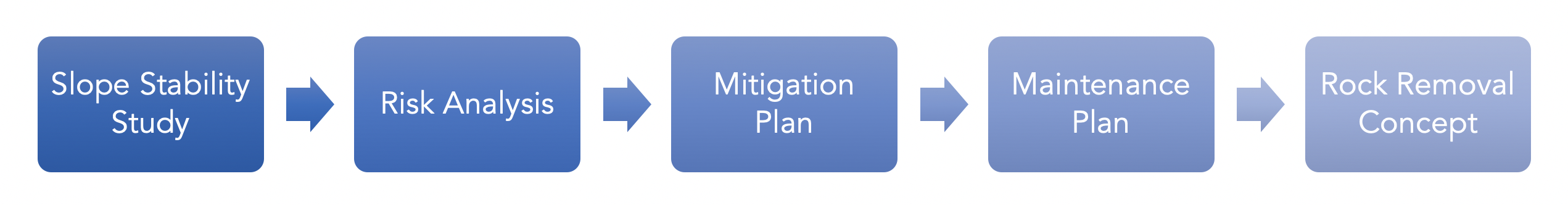
Overview
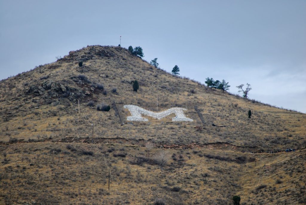
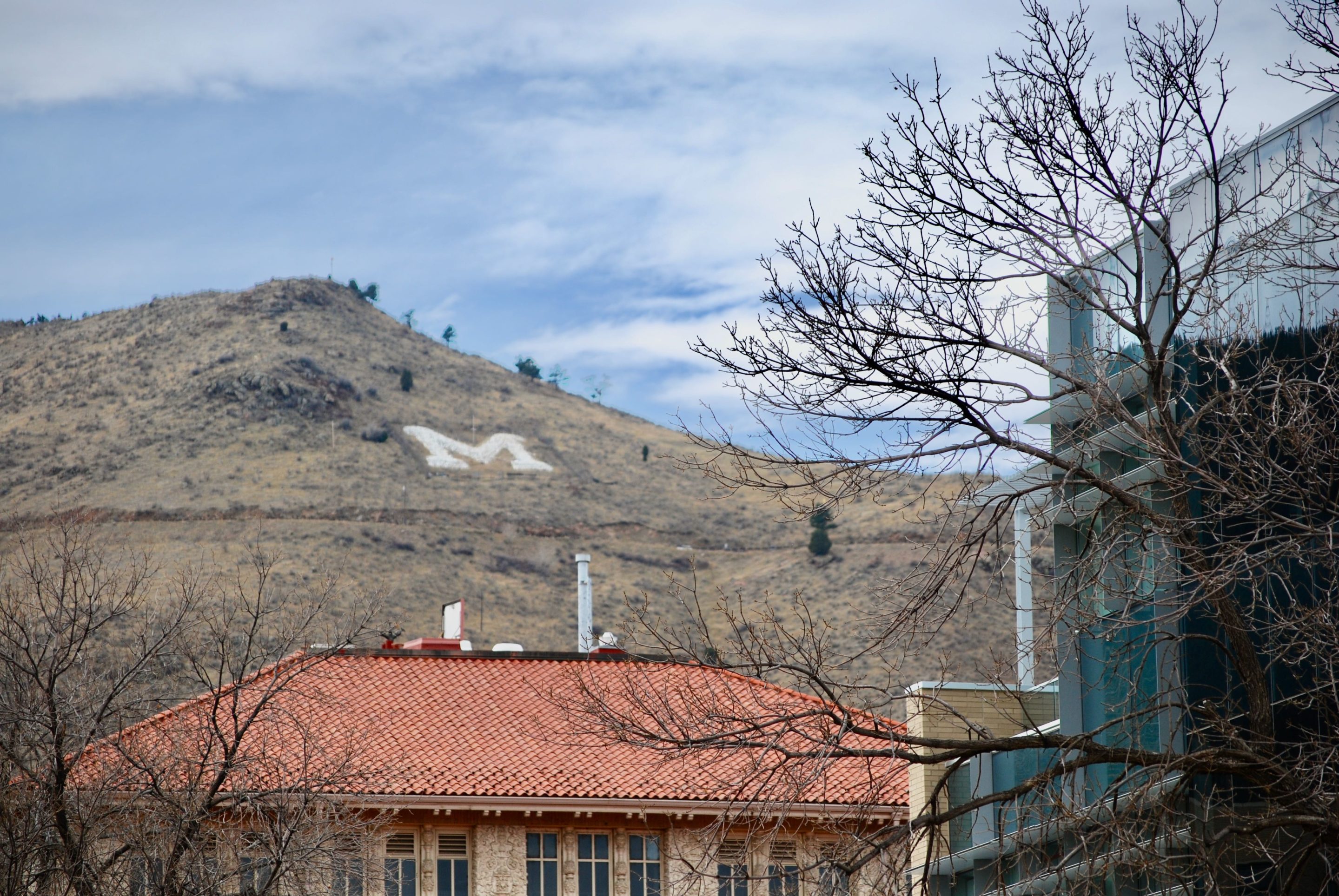
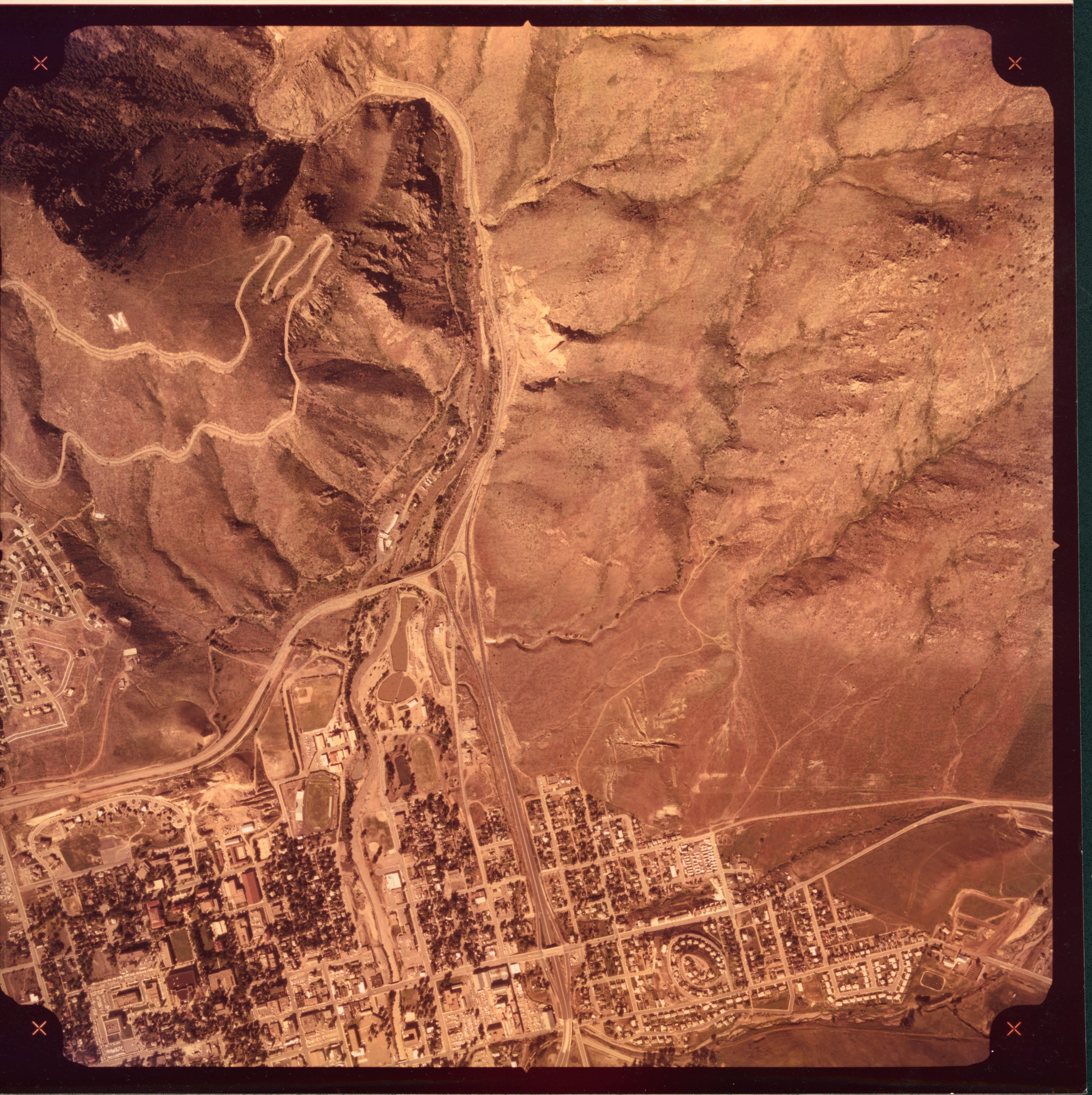
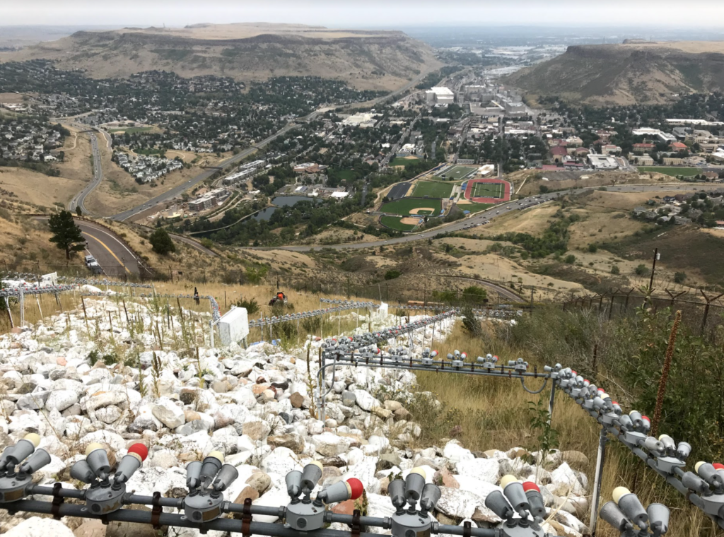
Each year, Colorado School of Mines hosts an annual M Climb event, where new students are invited to carry a 10 lb rock up Mount Zion to form the shape of an “M.” However, it is currently estimated that only one in every four rocks added to the M are removed. This tradition has led to concerns regarding the stability of the slope and sustainability of the M Climb tradition.
The goal of this project was to improve and ensure the longevity of the Colorado School of Mines M by completing a risk analysis and develop more sustainable rock removal practices. In order to reach this goal, five objectives were pursued:
-
- Complete a slope stability study
- Use this study to complete a risk analysis of the site
- Using these results, create a comprehensive mitigation plan
- Create a realistic maintenance plan
- Develop a more sustainable rock removal strategy

Live Zoom Chat
Use the link below to join us live from 8:00 – 10:30 a.m. on December 3.
Please use passcode: MSLOPE
Or iPhone one-tap: 13462487799,95454578189# or 16699006833,95454578189#
Or Telephone:
Dial: +1 346 248 7799 (US Toll) or +1 669 900 6833 (US Toll)
Meeting ID: 954 5457 8189
Team Members
- Zachary Budzik
- Kyli Doke
- Breanna Hedges
- Zana Jabari
- Sarah Olden
The Client
- Colorado School of Mines
- Clay Bosworth
- Chad Christian
Acknowledgements
Project Advisors: Emily Sievers, Jose Verissimo
Technical Advisors: Dr. Alexandra Wayllace, Dr. Pablo Chevesich, Jeffrey Holley, Dr. Andres Guerra, Jonathan Lovekin, PG (CGS), Dr. John Hopkins (CGS)
Other Contributors: Blue Key Honors Society, Jerry Nonko (CSM), Chris Thiry, Jefferson County Open Space, CSM SAIL Office, Colorado 811, Jaegger Olden, DPT, PT
Video
Elevator Pitch
 Unsustainable rock practices at the Colorado School of Mines “M” has sparked questions regarding the stability of the slope, safety of the student participants, and realistic rock removal practices for the site. The team completed a five-part investigation and action plan to provide answers and design new solutions to this ever growing issue. First, the team conducted a four-part slope stability study to understand the historic slope movement, soil strength beneath the rocks, rockfall potential, and erosional patterns. In short, this study concluded that in every instance, rockfall will occur before soil or slope failure. This data fueled the risk analysis at the site, where the determination of erosion, additional rock placement, and human live loads at the M are of highest concern. Next, a mitigation plan was created, outlining two major and simple solutions. First, a berm is to be put in place to protect the underlying infrastructure from small rockfall events. Next, native seeding will be used to help minimize seasonal erosion.
In addition, the team created a realistic maintenance plan to support the continuous use of the M site. This plan outlines best practices for annual inspections, rock removal, berm maintenance, and more. This plan includes a digital rock tracking system to be used to easily manage future rock additions and removals. Finally, the team created a two-part rock removal plan. The first part was the creation of addition rock removal events hosted by the Colorado School of Mines. These events were entirely planned by the team and will by hosted in the coming years, utilizing new traditions to sustain the M Climb tradition. In addition, the team designed a sectional rock chute to be installed at the site, and utilized during future rock removal events.

Slope Stability Study
 Goal: Determine the types of mass movements at the site, if slope deformation is occurring over time, and how susceptible Mount Zion is to mass movement in comparison to other slopes in Jefferson County, Colorado.
Methods: Use historical photos, Google Maps, ArcGIS, LiDAR imaging, and hazard maps to analyze the M site over time.
Results: Rockfall is the most prevalent mass movement type occurring at the site. Evidence was found that over time, rocks roll off the M and into the underlying fence. In addition, according to existing hazard maps for the county “landslide” failure, or risk of soil failure beneath the M is minimal.
Roadblock and Future Steps: No rate of slope movement was obtained due to lack of multiple LiDAR images. New LiDAR imaging of the site will be conducted by Jefferson County in spring of 2021. These images can be compared to existing public LiDAR images to determine a rate of slope movement, if any exists at the site.
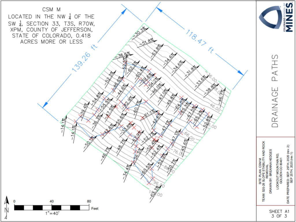
Erosion is the process of removing soil, rock, and organic matter from the earth through various weathering processes, including wind and water flow.
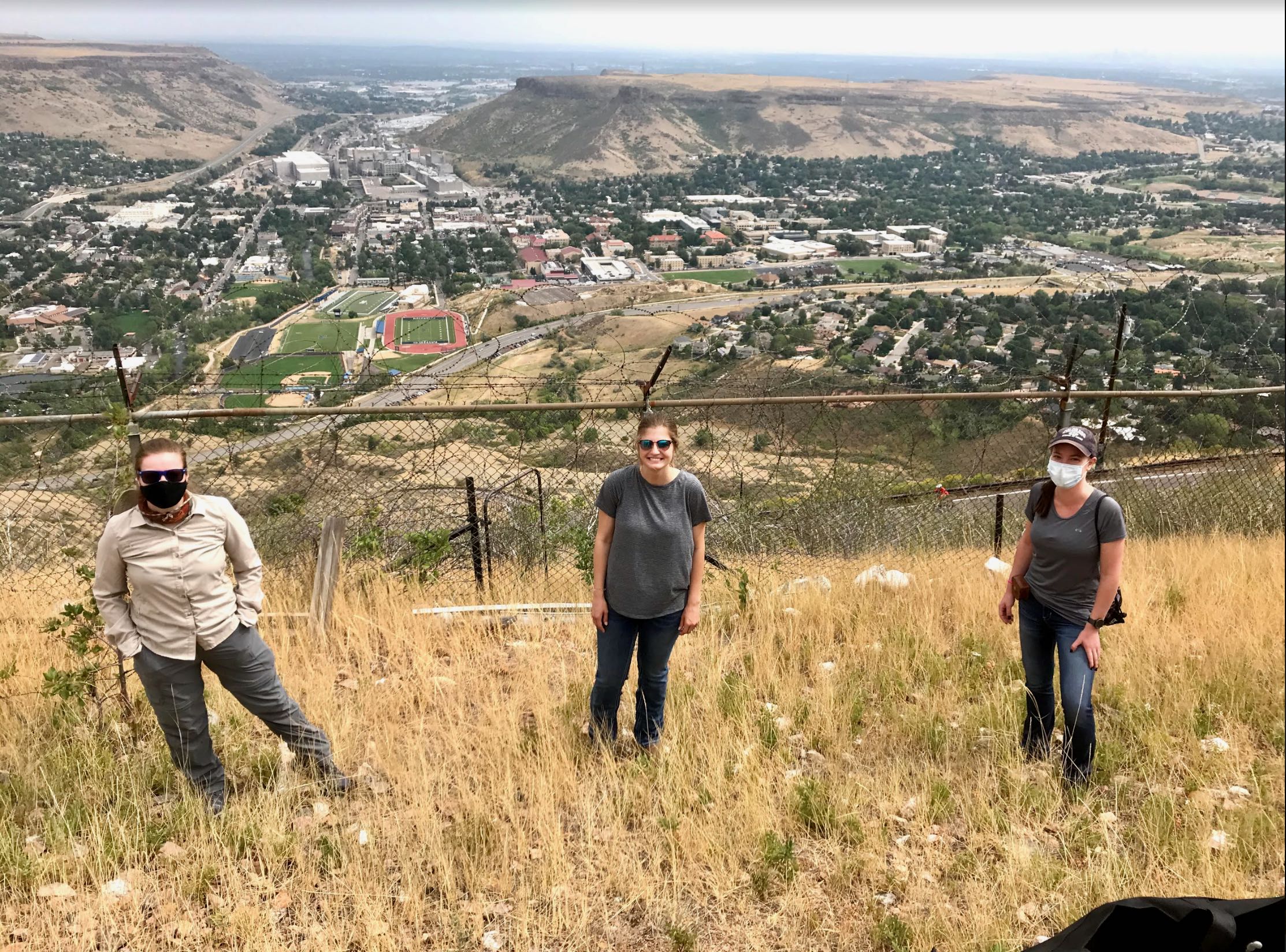
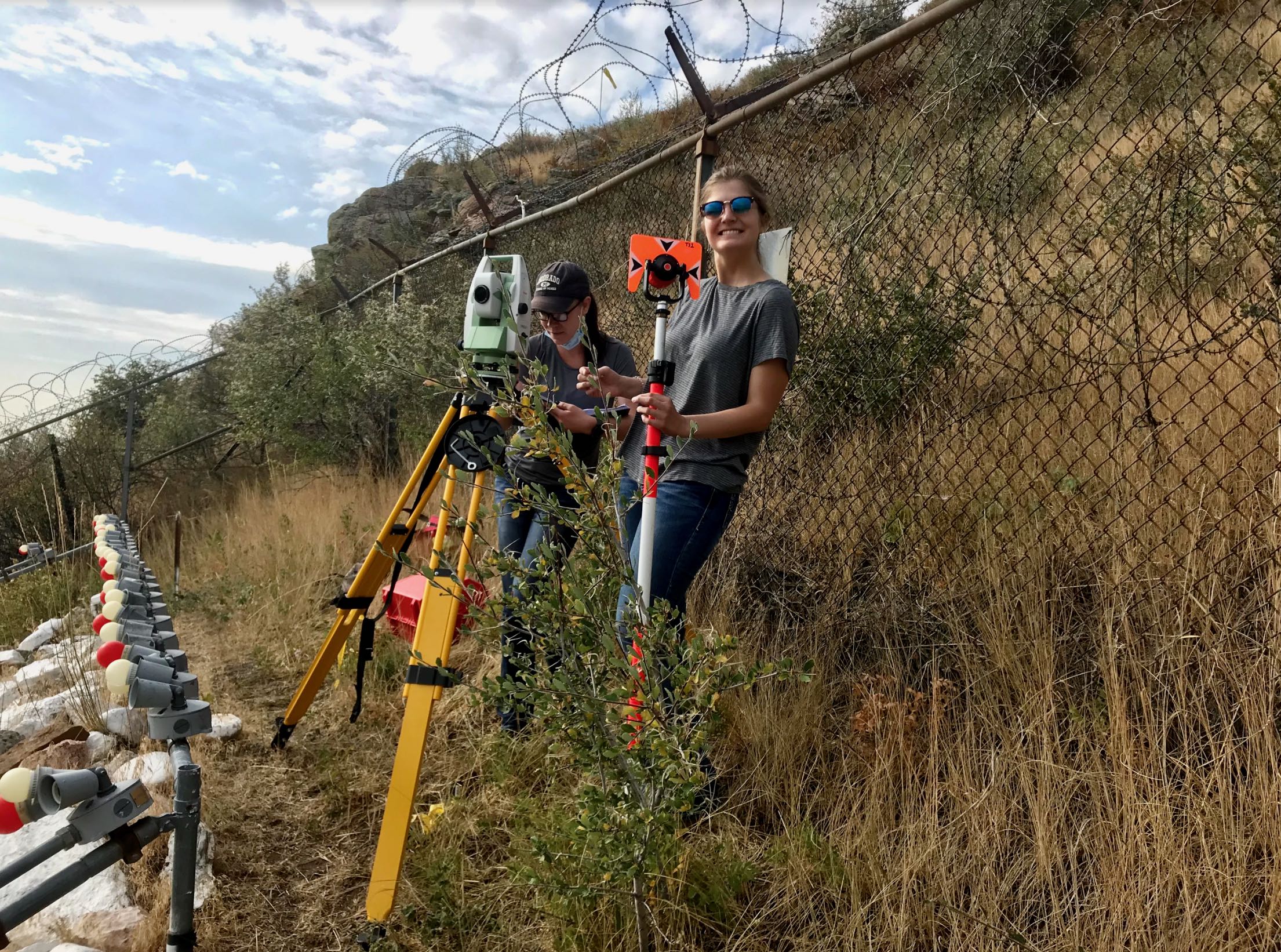
Goal: Measure the degree of erosion and map the drainage flow-paths at the M site to better understand what role erosion plays in the slope stability of the site.
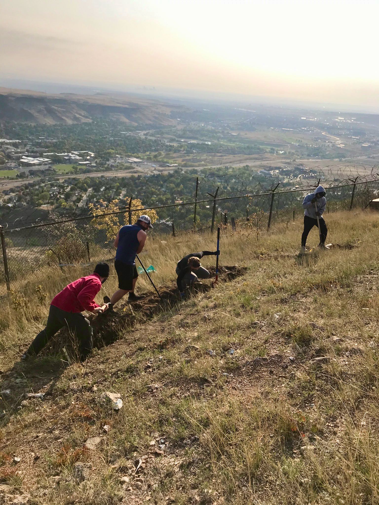
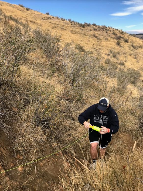
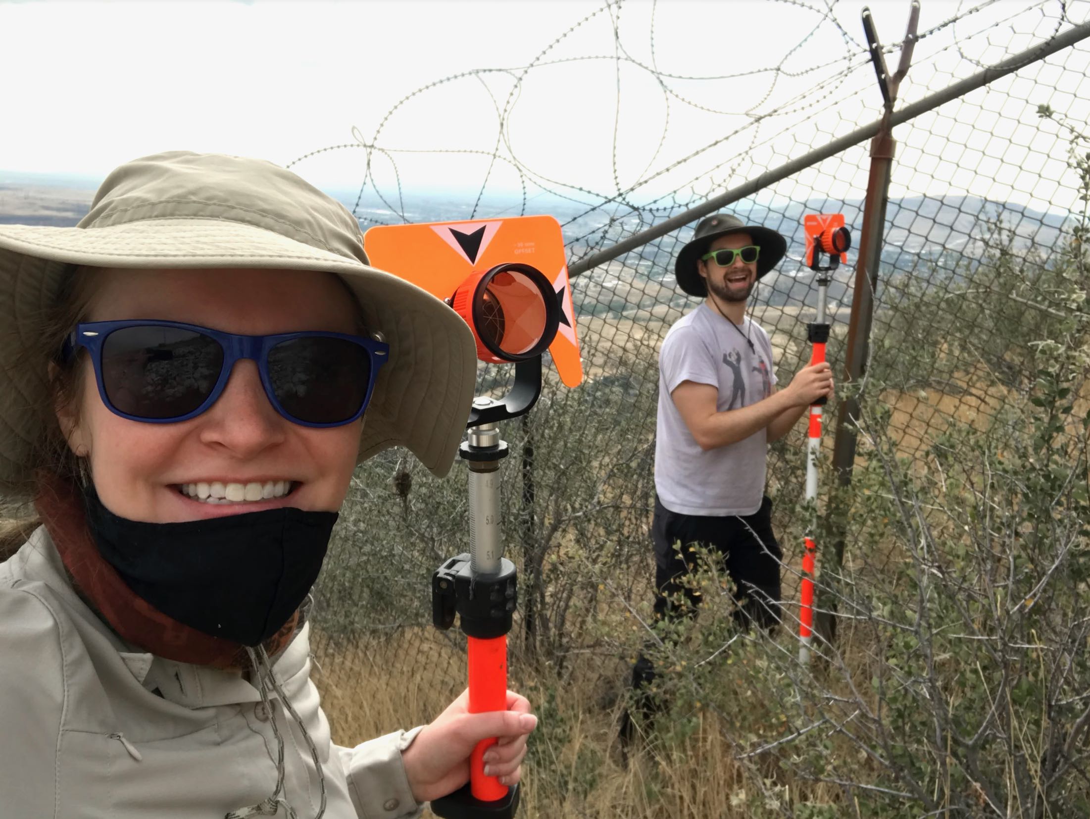
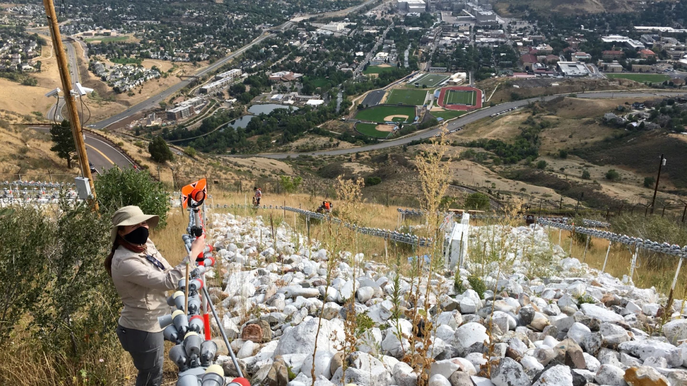
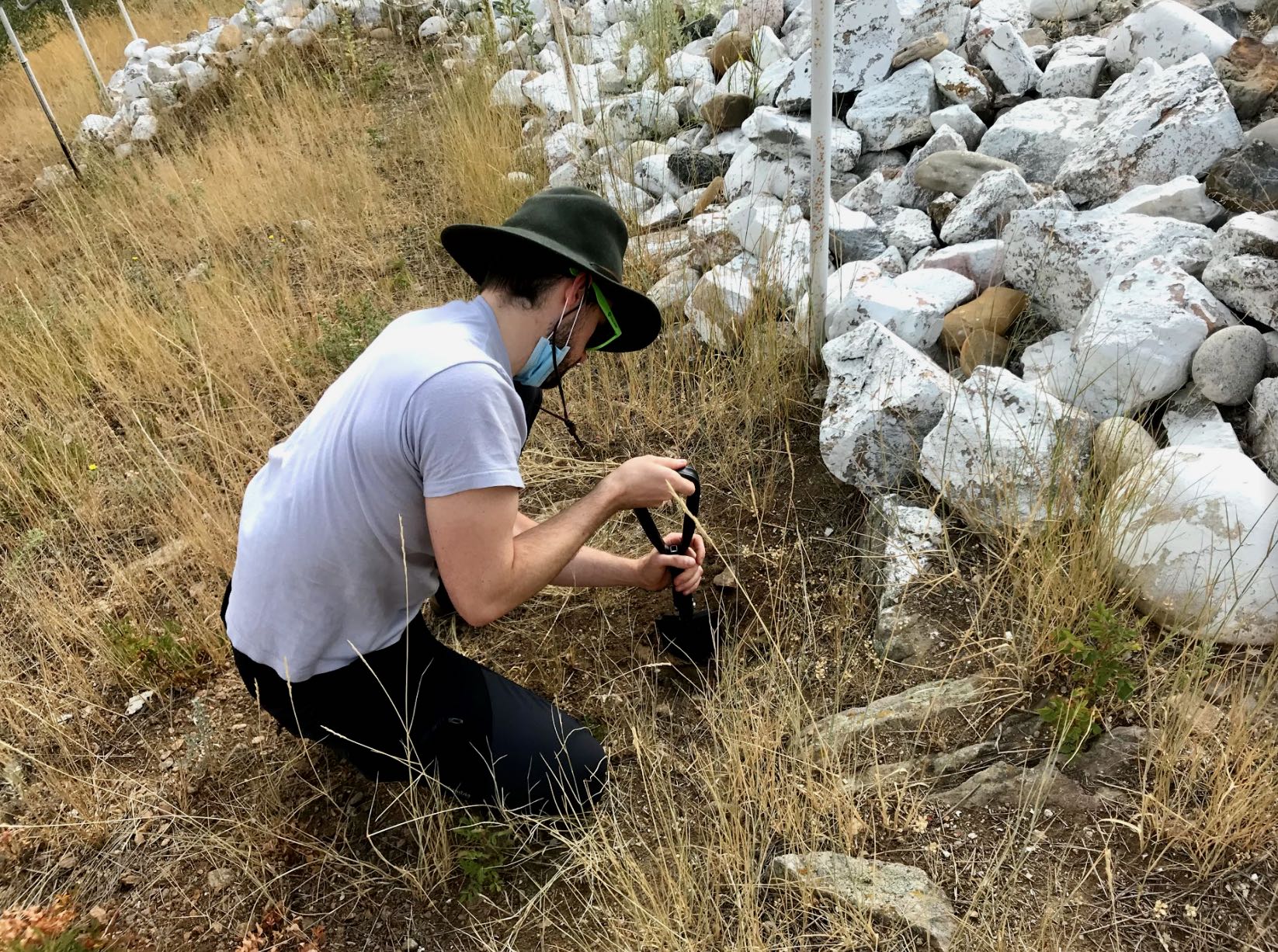
Methods: (1) Conduct a field survey using a Leica Total Station 02 and import this data into AutoCAD CIVIL3D for analysis. (2) Conduct a silt fence study at the site and hand-calculate the rate of erosion.
Results: The most concerning drainage paths were found at the base of the M shape, where the steepest slope indicates the highest rate of erosion. This has the potential to further the rockfall risk, as the erosion continues to eat away at this portion of the M.
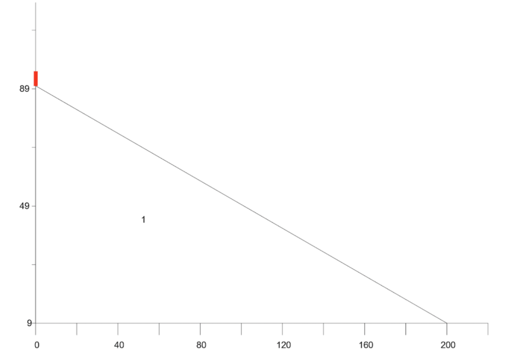
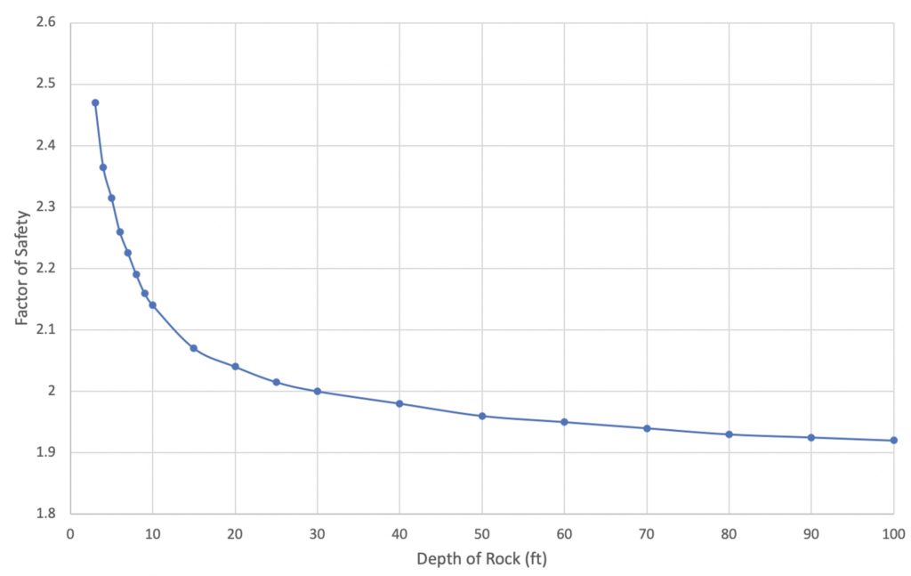 In slope stability, the factor of safety is the ratio of resisting forces to driving forces. For this study, the equilibrium method was used, which further defines the factor of safety as the ratio of shear strength to shear stress. The higher the factor of safety, the more stable a slope is. In this study, a factor of safety of 1.5 is considered unsafe, and a factor of safety below 1.0 is failure.
Goal: (1) Determine the factor of safety of the soil beneath the M based on current conditions. (2) Determine how many additional rocks can be added to the M before soil failure.
Methods: Conduct a soil depth survey at the site and combine the depth and soil type results of this study with previously collected data from two nearby geotechnical investigations, USGS geologic maps, and the US Department of Agriculture soil survey. This data was then added to the SLOPE/W program using both the Morgenstern-Price and Spencer Equilibrium methods to determine the factor of safety values at the site.
Results: (1) The current factor of safety at the site is 2.474. (2) Around 30 feet of additional rock thickness can be added to the M formation before the factor of safety reaches 2.0 (pictured). In all cases, factor of safety is never less than 1.9. Therefore, this study concludes that rockfall will occur before soil failure.
 Goal: Determine how many rocks can be added to the M before a large rockfall event occurs.
Methods: Use data collected at the site to run the Colorado Rockfall Simulation program (pictured).
Results: Over 30,000 rocks can be added to the M before any large rockfall event occurs.
Roadblock: The Colorado Rockfall Simulation has major limitations, including the inability to add moving live load to the slope and consider freeze-thaw conditions.
Risk Analysis
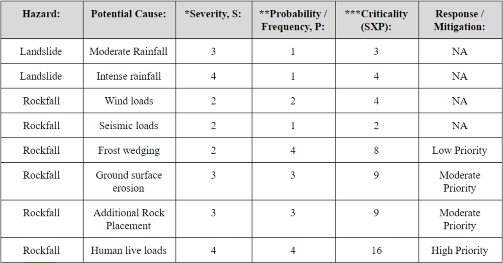 After compiling the data from the slope stability study, a complete risk analysis was completed for the site to evaluate both landslide and rockfall hazards. The summary of this assessment is in the figure to the right.
Severity: 1 indicates no effect on safety, 5 indicates multiple fatalities or loss of infrastructure
Probability: 1 indicates not likely or not anticipated, 4 indicates that event is likely to occur within 100 years
Criticality: Severity x Probability
Conclusion: Rockfall poses the highest risk at the M site, which may be caused by erosion, additional rock placement, and human live loads.
Risk Mitigation Plan
The results of the risk assessment suggested mitigation strategies to protect against rockfall and erosion would best serve the M site. After careful research and consideration, two mains strategies have been recommended by the team:
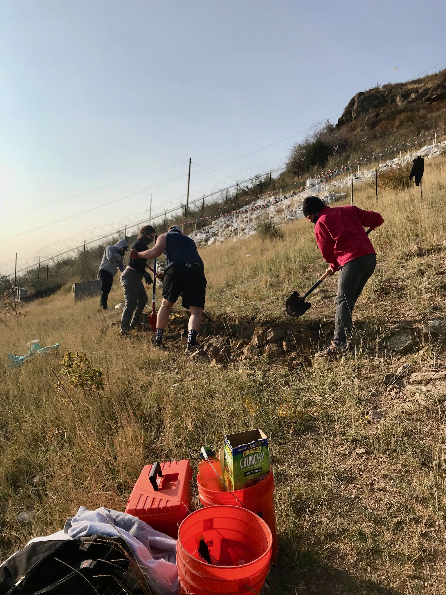
The Installation of a Berm: A berm is a mound of earthen material that is recommended to be placed just inside the fence line of the M. Berms have historically been proven to catch rocks at a reliable rate. A berm is inexpensive, easy to install, and in many cases, blends in with the surrounding environment. Drainage is the main consideration that should be taken during the construction of this structure.
The Addition of Native Seeding: Native seeding is an easy and reliable protection agent against erosion. At the M site, it is suggested that native grasses be planted in all soil regions around the M, but especially at the base of the shape. It is recommended that native seeding be completed every spring or until grasses are present at the site year round. The grass species recommended for Mount Zion are Sideoats Grama and Sun Sedge, which are known for their extensive root systems, low height, and high seasonality tolerance.
Maintenance Plan
In order to sustain the M climb tradition, optimize design goals, and continue to manage hazards on the site, the following maintenance strategies have been recommended:
- Future Rock Additions: Additions of rock to the site will be tracked using a new rock tracking spreadsheet. This new system will maintain a running total of rocks located at the site and can be updated as rocks are added and removed.
- Erosion Control: The site is to be re-seeded every spring or until grasses remain at the site continuously.
- Site Fence and Proposed Berm: The existing fence and proposed berm at the M site will be maintained by: remove excessive rocks rocks once per year, visually inspect for structural integrity frequently and replace if deemed necessary.
- Trail to M Site: The trail leading to the M site is located in Jefferson County Open Space and is classified as an undesignated trail. Because of this, Jefferson County actively restores the trail and is responsible for its maintenance. Therefore, there is not a set plan for maintenance of the trail as it pertains to Colorado School of Mines. Small maintenance practices may be completed in preparation for the annual M climb as needed.
- Proposed Rock Chute: The biggest concern for maintenance of the rock chute is damaged or broken parts. In order to prepare for this, additional parts will need to be ordered during the initial manufacturing process. If all spare parts are used, CAD drawing will be provided in order to manufacture more parts that fit with the original rock chute.
Rock Removal Concepts
Two major rock removal concepts have been recommended. The first, additional rock removal events, have been planned and are currently scheduled to take place. The second, the manufacturing and usage of a sectional rock chute, is advised to be constructed if deemed necessary in the future.
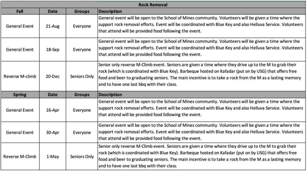 Four additional rock removal events, to create six total events per year, have been organized and created with the collaboration of the Colorado School of Mines SAIL office and Blue Key Honors Society. A summary of each of these events, and rough data estimate can be found in the figure to the right.
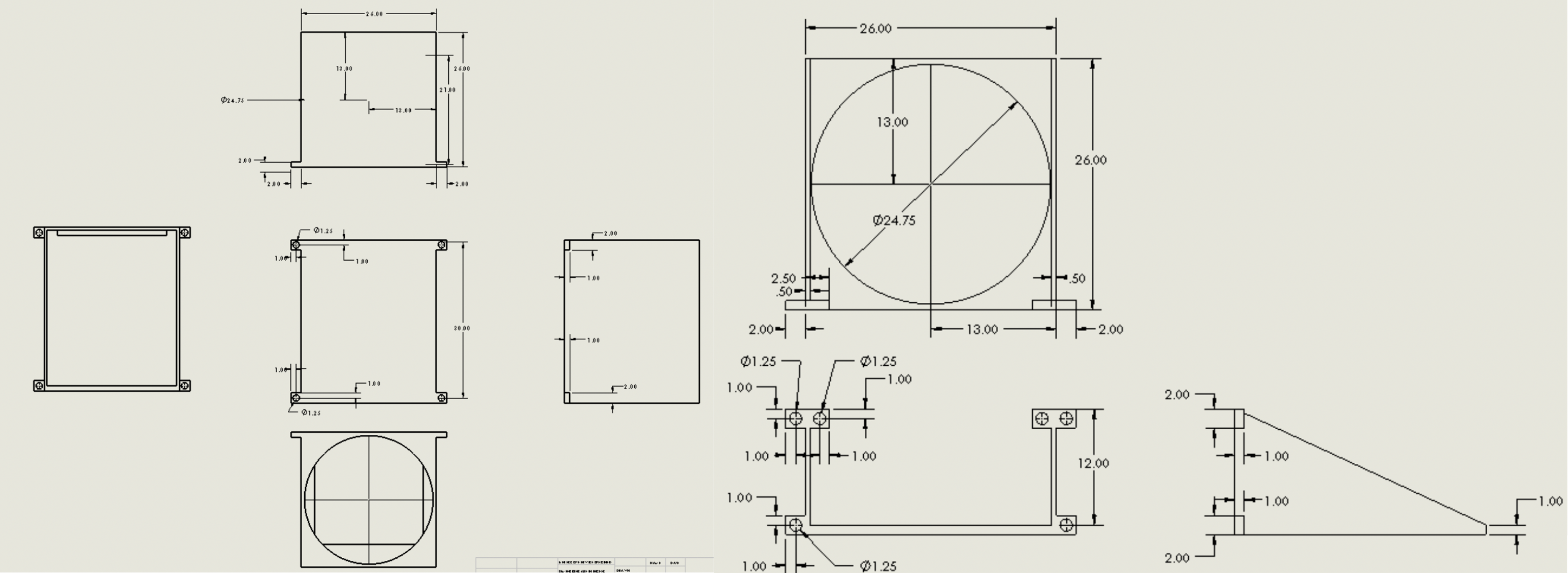
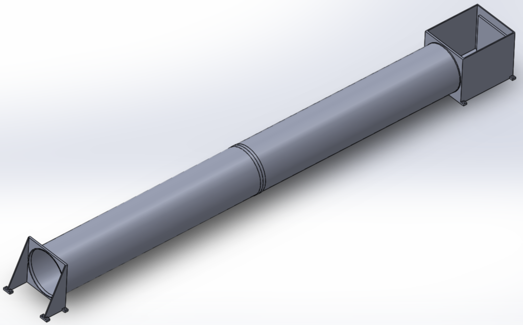 To support the additional rock removal events and aid the schools efforts in future rock removal, a design for a sectional rock chute has been created. This chute is circular in shape and features a collapsable system that allows the chute to be easily installed and uninstalled within a single day. This feature allows the Colorado School of Mines to adhere to the Jefferson County Open Space regulations. Additional benefits include a safe and controlled design that prevents rocks from leaving the chute during movement.
This chute is to be installed at along the M trail outside of fence and follow an existing undesignated trail down the hill to the M site parking area. The concept of this sectional rock chute can be seen in the provided image, and detailed drawings have been submitted to the school for future use. The chute tube, entrance mount, and removal chute are rigid, with a flexible center tube that runs along the length of the slope.
Next Steps
 The team recommends several steps to be taken by the school in order to protect the M site and ensure the M climb tradition is enjoyed for years to come. First, yearly native seeding at the site will help protect the from erosion and slow the rockfall process, especially at the base of the structure. In addition, it is recommended that a berm be built just inside the fence line to protect the fence and underlying roadway from rockfall.
The team also recommends the usage of a rock tracking spreadsheet that has been created to ensure the maximum number of 30,000 rocks is never reached. Also, the team suggests frequent inspections of the fence, berm, and site and the removal of rocks each year, if deemed necessary. However, the four additional planned rock removal events should decrease this requirement.
In the future, if deemed necessary, the school should pursue the construction of the designed sectional rock chute to assist in rock removal efforts. In addition, the school should pursue a partnership with Jefferson County Open Space to explore trail widening options. This would allow for two-way traffic to and from the site to further assist with rock removal.
Meet the Team
Zachary Budzik
 Role: Design Team
Major: Mechanical Engineering
Future Plans: My plan is to return to Mines to pursue a Master’s degree in Engineering and Technology Management (ETM) while participant in my final 6th year of collegiate football.
Fun Fact: Even though I am a large human, I’ve had a crippling fear of needles ever since I can remember.
Kyli Doke
 Role: Communications Manager
Major: Civil Engineering
Future Plans: Graduate School at Colorado School of Mines (Graduating May 2021)
Fun Fact: My favorite activity is dirt biking with my family.
Breanna Hedges
 Role: Document Organizer and Project Testing Manager
Major: Civil Engineering
About: I’m an enthusiastic learning with a passion for self improvement. I attribute happiness to having a strong sense of responsibility, self discipline, and love for oneself and others. I particularly thrive in collaborative environments, and I believe obstacles are an opportunity to practice some virtue, such as patience, courage, humility, creativity, and justice.
Interests/hobbies: Reading, cooking, eating, hiking, and hunting
Zana Jabari
 Role: Design Team
Major: Mechanical Engineering
Future Plans: Work in the aerospace industry
Fun Fact: I’ve traveled to over 20 countries.
Sarah Olden
 Role: Project Manager and Webmaster
Major: Civil Engineering
Future Plans: Graduate school at Colorado School of Mines to study Civil and Geotechnical Engineering (Graduating December 2021)
About: I am a driven, organized, and optimistic student with a passion for infrastructure. Growing up on Washington State’s coastline, I’ve always been fascinated with hazards affecting my community. Since then, I have made it my mission to become a civil engineer and use my intellect to find solutions that ensure public safety.
Hobbies/Interests: Rock climbing, hiking, swimming, and blogging at The Olden Chapters